Creating Maps
Map creation can be done with Windows Paint and Notepad, no other programs are
required.
You need to create two files, .bmp and .txt in MyDocuments\Empire XP dir.
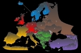
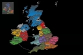
Have a look at the example WorldII files which reside in the same directory before you begin.
(more examples are available at janbuurstrasoftware.com/mapdownloads )
The following steps need to be performed to create a map of your own:
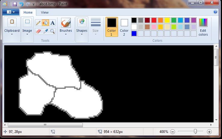
Create the .bmp file
Open the Paint program and create a .bmp file, dimensions: 954 x
632 pixels.
Name the file after the map you are creating, such as
Asia.bmp, Africa.bmp etc.
Names must be 13 characters or less
(extension excluded) and without spaces.
Paint the outlines of continents and territories using any grey color or dark red rgb(128,0,64).
The grey colors must have equal RGB values, examples
182,182,182 or 93,93,93
The interior of a territory should be all white.
Thicker lines/brushes are also possible.
Make sure no gaps exist between pixels. Zoom in (Ctrl-PgUp) to have a better look.
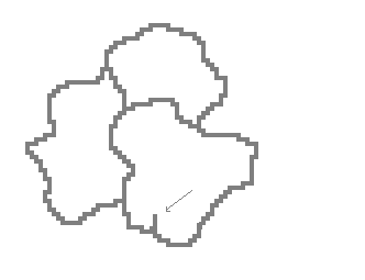
Apply a double-line / a thick brush as a border between
continents (grey or dark red).
Grey areas cannot be crossed (use this to create difficult to reach areas).
The same can be achieved by drawing 'lakes'.
Lakes should be completely enclosed by grey or dark red lines.
Oceans and lakes: select the Flood Fill Tool and Flood Fill with Black.
Grey areas: Flood fill with light grey.
Draw white lines to show connections over water (don't draw
over the grey
territory lines !).
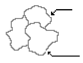
Do not create territories completely surrounded by 1 other
territory, like San Marino in Italy.
Avoid these needle shaped artefacts.
With Solid colors on (Settings -> Appearance -> Solid Colors) the needles and
San Marinos are possible.
Print it out and number the countries (starting with 1) on the printout with a
pen.
Be aware that, within a continent, the territory numbers must be in sequence.
Create the .txt file
Open the Notepad program and create a file with the same name as the .bmp
file but with the extension '.txt'
Add the following lines including the square brackets, they are the section
headers:
[map]
[player names]
[smilies and codes]
[continents]
[territories]
Below is a detailed description of each section and what should be entered under
each heading.
map section
enter the name of your map (should be equal to the .bmp file
name without the extension)
13 chars max.
player names
x and y (in pixels), the upper left corner where the program
shows the player names,
select a point in a large expanse of empty ocean.
example:
686 295
Note: Paint shows the coordinates of the cursor at the lower left corner.
smilies and codes
Y or N; N = don't show smilies and codes (the three-letter
territory code), useful for small territories.
The # of armies is always present.
continents
enter all your continents here, 1 line is 1 continent, examples :
5 France 10 11 12 13 14 15 16 17
2 Iberia 18 19 20 21
...
..
.
Explanation of first line:
first number ( 5) : the number of bonus armies given for holding this continent.
France : continent name, 20 chars max, no spaces allowed (eg GreatBritain, not:
Great Britain)
10 11 12 ..
: enter all the numbers (territories) that are part of this
continent (the numbers you wrote on the printout).
All items must be separated from their neighbours by exactly one space.
territories
enter all your territories here, 1 line is 1 territory, examples
:
1 sco 262 80 3 4
2 irl 169 140 3 5
...
6 cor 238 218 5 3 4 7 20
...
..
.
Explanation of first line:
first number (1) : territory number (the numbers you wrote on the printout)
three-letter code (sco) : territory code (displayed together with the army
count)
numbers
262 80
: x and y (in pixels) of the center of the territory.
The program uses these to show the territory code and # of armies.
Note: Paint shows the coordinates of the cursor at the lower left corner.
numbers 3 4
: enter all bordering countries here (you can attack territories 3
and 4 from this territory)
- don't forget the connections over water!
Testing your map :
From within the game, go to Map, Test a Custom Map..., now load your new map.
The army number (72) and the white dot must both lie in the interior of the
territory.
Run the program in Demo mode (computer players only) and choose Load a Map.
the map disappears ? everything has the same color ? possible reasons for this
could be :
gaps! (see above) or
misfiring pixel coordinates or
territory too small to hold the code/smiley or # of armies
if the above mentioned happens :
remove all the territories but one (territory 1) from the [territories]
section of the .txt file
run the program and choose Map -> Load a Map... You should see white
territories (all except 1)
add territory 2 to the .txt file and repeat the test, go on adding territories
until you find the troublemaker.
Buffer underrun error ? Set [smilies and codes] to N. (your
territories are too small to surround the smilies)
The following limits apply to a map:
. maximum number of territories is 200 (LAN/Internet
game: 115)
. maximum number of continents is 25 (LAN/Internet game: 14)
. maximum number of territories per continent is 20
. maximum number of border territories per continent is 12
. maximum number of surrounding territories per territory is 11
. minimum number of territories is 10
. minimum number of continents is 2
. minimum number of territories per continent is 2
1920x1080 and 4K sized map
If you also want to make a map for 1920x1080 and 4K screen size :
Copy the .bmp file to same name + _2.bmp, eg. asia.bmp and asia_2.bmp
Open Paint and load asia_2.bmp
In Paint -> Image -> Resize/Skew -> Stretch : Horizontal 125% , Vertical 125%
Check for gaps again and repair the damage caused by the stretch image command
At runtime the program decides which .bmp to use, depending on the actual screen
size.
Misc
you may, if you like, e-mail your map to me, I will then list your map on the
'download maps' page.
Compress the files into one .zip file.
Custom maps can be used like the built-in ones, including LAN and Internet games
(map files must be stored locally on every PC).
One-way streets are unusable in empire xp, since the AI ignores them (but they
can exist for human players).
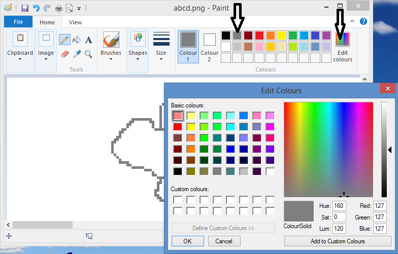
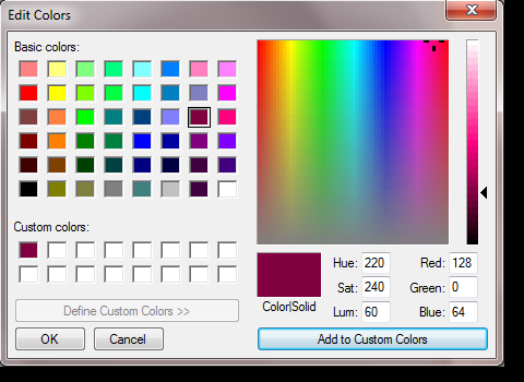
Dark red, rgb(128,0,64) border/outline color
This color can be applied in the following way: Colors->Edit Colors...->Define
Custom Colors>>
Troubleshooting
Territories without .... error :
It means that there are unreachable countries,
example:
[territories]
1 a01 229 145 3 2
2 a02 273 195 1 4
3 a03 222 226
4 b01 500 125 5 6 12
...
terr. a03 is such a country
Or you forgot to specify any country names, or the name is
too long.
tr too large error:
This means that a computer player found more than 40000
roads to go from country A to country B.
This array limit (40000) is for performance reasons.
It can happen when the map contains a large chunk of countries without any
artificial borders,
so adding barriers (mountains, deserts , rivers etc) should solve the problem.